Santa Barbara Maps for Biking
Welcome to the best and 100% free Santa Barbara maps resource. Our team of local cyclists have put together our favorite bike rides to save you time and stress when planning your next Santa Barbara bicycle ride. The following maps include a variety of bike path maps and bike friendly streets to help you locate the best possible bike rides for your next trip to Santa Barbara.
Skip ahead to your favorite bike path maps by selecting a map below:
Waterfront & Downtown | 16 Miles |
Road Bike Maps | Ranging 26-40 Miles |
Mountain Bike Maps | Ranging 7-14 Miles |
For Garmin Connect Files of our bike maps click here
Skip the stress of navigating and let our local guides show you the way! Book a bike tour on our adventure site: Cal Coast Adventures Bike Tours
Map #1. Downtown & Waterfront
This is the most popular ride that our bike renters enjoy as it is only 16 miles and primarily flat. In order to see the beautiful bicycling paths on this ride you will need to be ready for 600 feet of biking uphill. The highlight of this ride is the crown jewel of bike paths in Santa Barbara. Leadbetter beach to Butterfly beach boasts 5 miles of oceanfront bike path riding.
Map #2. Road Bike Maps
This map includes 4 must-do road bike rides in Santa Barbara. The two bike rides that navigate you up the coast towards Goleta and down the coast towards Carpinteria are great beginner bike rides for riders looking to see the best bike paths in Santa Barbara. For more experienced cyclists that aren't afraid to climb our favorite bike ride is the intermediate loop around town that shows you the amazing views along Mountain Drive and through the shaded neighborhood of Hope Ranch. If you're looking for the bucket list epic bike ride that takes you up the mountain, along the ridge, and back down into town look no further than THE RIDGE. Santa Barbara's famous climb up Gibraltar and down Painted Cave / Old San Marcos Road.
- Goleta Bike Trail Loop (UBSB) | 34 Miles 900 feet of climb ~ easy
- Carpinteria & Goebernador | 31 Miles 1.2k feet of climb ~ easy
- Montecito & Hope Ranch (Recommended Loop) | 26 Miles 2.8k feet of climb ~ intermediate
- The Ridge (epic climb up and around the mountain) | 40 Miles 6.7k feet of climb ~ advanced
Map #3. Mountain Bike Maps
This map includes the 6 mountain bike rides that you should put on your radar when mountain biking in Santa Barbara. When looking for a bike trail near me I always end up biking over to Elings Park. Elings Park is our number one recommendation and a great bike park with a variety of features and stunning views of the ocean and city. Elings park is an intermediate trail network but can be enjoyed by beginners and advanced riders alike. For our second and third favorite bike trails we recommend riding the Romero Fire Road and Camuesa Connector. Both are intermediate blue level trails that offer majestic views and Santa Barbara's flowiest singletrack. For all of our beginners out there be sure to checkout the ocean bluffs of Elwood preserve and the eucalyptus grove singletracks. If you're an advanced level mountain biker that can handle black diamond trails then Jesusita trail is a must. The climb up the mountain can be brutal but the descent will make it all worth it. Jesusita is Santa Barbara's most challenging and most rewarding downhill ride.
- Elings Park | 2-7 miles of intermediate singletrack with jumps!
- Romero Fire Road | 6.5 miles up and 6.5 miles down on flowy and fast singletrack in Montecito! (first 1.5 miles is fire road and the rest is singletrack)
- Camuesa Connector | 10 mile loop in the backcountry of the Los Padres National Forest with a 3.5 mile descent that rocks.
- Jesusita Trail | Santa Barbara's best 9 mile loop for advanced riders. Brutal climb but rewarding descent. Downhill involves rock gardens and rock steps.
Garmin Connect Files
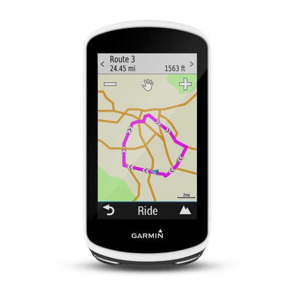
If you're traveling with your own bike computer such as a garmin or wahoo you can view our bike path maps on garmin connect and transfer them to your device. We have made all of our Santa Barbara maps public on garmin connect so that you can navigate our city with help from your bike computer. If you don't own a garmin or you'd rather avoid the trouble of packing your garmin or transferring the gpx files onto your device we also offer garmin rentals. We carry a Garmin Edge 1030 and Garmin Edge Explore pre-loaded with all of our meticulously designed Santa Barbara maps. When booking your bike rental with us be sure to select the garmin upgrade option on the second page of checkout so that you don't miss out on all of the bike paths in Santa Barbara.
Don't have a Bike Computer? We got you covered!
NEW - Rent a Garmin Edge 1030 with your Bike Rental

Explore Santa Barbara with Confidence
- Only $20 for 1 day and $5/day for everyday thereafter
- Loaded with Santa Barbara biking routes for all riding levels
- Easy to see step by step navigation
- Track and record a variety of riding data and metrics
- Simple to use interface with large screen
- Enjoy a bike ride that you know you'll love without getting lost!
To Reserve the Garmin Edge 1030 Computer please select the item in checkout
SB Traffic Solutions Maps
Santa Barbara County Bike Path Map (Paper Map Available at our Bike Shop and Downloadable PDFs Below)
